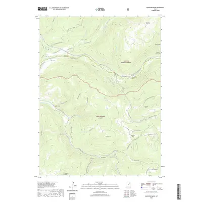
2020 Map of Soapstone Basin
USGS Topo · Published 2020About this map
The high-elevation divide between Wasatch National Forest and Uinta National Forest defines this landscape, where the headwaters of the Provo River and Strawberry River originate. The topography is marked by significant engineering and seasonal transit routes, notably the West Portal Duchesne Tunnel and the Mirror Lake Highway, which transitions to a winter route at these altitudes. Local history is etched into the terrain through family and industrial place names such as Pitt and Page Hill, Lambert Hollow, and Iron Mine Creek. The area around Soapstone Mtn and Soapstone Pass serves as a critical junction for high-country trails and forest roads, including the Soapstone Basin Atv Trail and Colorado Springs Rd. This survey documents a wilderness area shaped by water management and recreational use, from the Soapstone Ponds to the remote reaches of Silver Meadow.
Find a feature on this map
51 named features on this map. Tap any name to fly to it.
Don’t see what you’re looking for? This feature index may not catch every label — zoom into the map to look around manually.
Map Details
Editions of this 2020 Soapstone Basin Map
This is the sole edition of this map. No revisions or reprints were ever made.
Other maps of this area

1885 · Salt Lake
USGS Topo · 1:250,000

1885 · Uinta
USGS Topo · 1:250,000

1900 · Coalville
USGS Topo · 1:125,000

1901 · Hayden Peak
USGS Topo · 1:125,000

1903 · Hayden Peak
USGS Topo · 1:125,000

1903 · Coalville
USGS Topo · 1:125,000

1907 · Strawberry Valley
USGS Topo · 1:125,000

1909 · Strawberry Valley
USGS Topo · 1:125,000

1954 · Salt Lake City
USGS Topo · 1:250,000

1958 · Salt Lake City
USGS Topo · 1:250,000