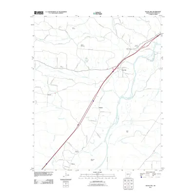
2011 Map of Social Hill
USGS Topo · Published 2011About this map
The Ouachita River snakes through this portion of Hot Spring County, defining a landscape shaped by water and timbered ridges. To the north, Easely Mountain rises above the confluence of Blakely Creek and the North Fork Blakely Creek, while the southern reaches feature the broad Elmo Flats and Morrison Island. This area is characterized by small, dispersed communities like Social Hill and Midway, connected by a network of rural routes such as Antioch Rd and Possum Trot Rd. For those researching local heritage, the map identifies several burial sites including Alford Cemetery and Neighbors Cemetery, alongside established settlements like Oak Grove and Antioch. The spatial arrangement of these family cemeteries and crossroad communities reflects the long-standing agricultural and forestry traditions of the region.
Find a feature on this map
66 named features on this map. Tap any name to fly to it.
Don’t see what you’re looking for? This feature index may not catch every label — zoom into the map to look around manually.
Map Details
Editions of this 2011 Social Hill Map
This is the sole edition of this map. No revisions or reprints were ever made.
Other maps of this area

1948 · Malvern
USGS Topo · 1:62,500

1949 · Malvern
USGS Topo · 1:62,500

1955 · Little Rock
USGS Topo · 1:250,000

1956 · Little Rock
USGS Topo · 1:250,000

1959 · Caddo Valley
USGS Topo · 1:24,000

1960 · Little Rock
USGS Topo · 1:250,000

1964 · Little Rock
USGS Topo · 1:250,000

1964 · Donaldson
USGS Topo · 1:24,000

1965 · Round Hill
USGS Topo · 1:24,000

1966 · De Roche
USGS Topo · 1:24,000