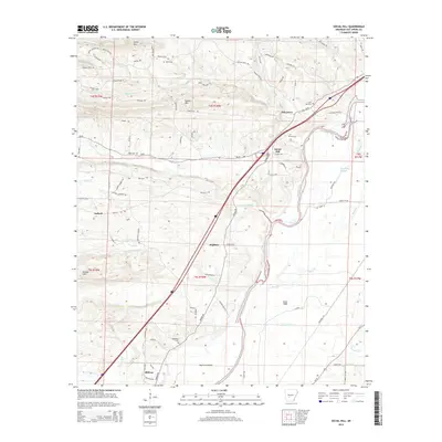
2014 Map of Social Hill
USGS Topo · Published 2014About this map
The Ouachita River snakes through this landscape, creating a distinct boundary between the elevated terrain to the northwest and the river bottoms of Elmo Flats to the southeast. Settlements such as Social Hill and Oak Grove are linked by the local road network, while smaller rural nodes like Saginaw and Midway sit further south. The topography is defined by prominent elevations including Shinn Mtn and Easely Mtn, which rise above a network of waterways like Blakely Cr and Prairie Bayou. For those researching local family histories, the inclusion of several burial grounds—including Alford Cem, Lone Hill Cem, Ward Cem, and Neighbors Cem—provides specific locations for genealogical mapping. The map also reveals the transition from higher ground at DeLisle Hills down toward the wetlands of Drowning Slough, illustrating the varied geography of the region.
Find a feature on this map
91 named features on this map. Tap any name to fly to it.
Don’t see what you’re looking for? This feature index may not catch every label — zoom into the map to look around manually.
Map Details
Editions of this 2014 Social Hill Map
This is the sole edition of this map. No revisions or reprints were ever made.
Other maps of this area

1948 · Malvern
USGS Topo · 1:62,500

1949 · Malvern
USGS Topo · 1:62,500

1955 · Little Rock
USGS Topo · 1:250,000

1956 · Little Rock
USGS Topo · 1:250,000

1959 · Caddo Valley
USGS Topo · 1:24,000

1960 · Little Rock
USGS Topo · 1:250,000

1964 · Little Rock
USGS Topo · 1:250,000

1964 · Donaldson
USGS Topo · 1:24,000

1965 · Round Hill
USGS Topo · 1:24,000

1966 · De Roche
USGS Topo · 1:24,000