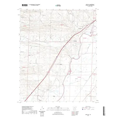
2020 Map of Social Hill
USGS Topo · Published 2020About this map
The Ouachita River winds through the southeastern portion of this Hot Spring County landscape, defining the topography near Morrison Island and the broad Elmo Flats. This 2020 survey reveals a rural settlement pattern deeply connected to the winding secondary roads and creek valleys of the region. Localities like Social Hill and Oak Grove serve as community hubs along the northern corridor, while Midway and Antioch anchor the southern and western reaches. Genealogists will find significant value in the distribution of family and community burial grounds, including Lone Hill Cem, Alford Cem, Ward Cem, and Neighbors Cem. The terrain is characterized by prominent rises such as Shinn Mtn, Easely Mtn, and the DeLisle Hills, which overlook a network of watercourses including Blakely Cr, Prairie Bayou, and DeLisle Cr. The presence of the Saginaw settlement further highlights the area's historical development and transportation routes between the hills and the river.
Find a feature on this map
88 named features on this map. Tap any name to fly to it.
Don’t see what you’re looking for? This feature index may not catch every label — zoom into the map to look around manually.
Map Details
Editions of this 2020 Social Hill Map
This is the sole edition of this map. No revisions or reprints were ever made.
Other maps of this area

1948 · Malvern
USGS Topo · 1:62,500

1949 · Malvern
USGS Topo · 1:62,500

1955 · Little Rock
USGS Topo · 1:250,000

1956 · Little Rock
USGS Topo · 1:250,000

1959 · Caddo Valley
USGS Topo · 1:24,000

1960 · Little Rock
USGS Topo · 1:250,000

1964 · Little Rock
USGS Topo · 1:250,000

1964 · Donaldson
USGS Topo · 1:24,000

1965 · Round Hill
USGS Topo · 1:24,000

1966 · De Roche
USGS Topo · 1:24,000