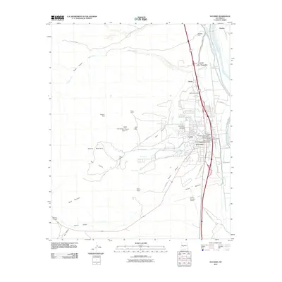
2010 Map of Socorro
USGS Topo · Published 2010About this map
Socorro and its diverse historic districts form the core of this Rio Grande valley study, showcasing the layering of New Mexico history from colonial-era foundations to modern scientific research. The town's deep heritage is visible in the Chihuahua Historic District and the San Miguel Historic District, anchored by the San Miguel Church. Beyond the residential areas, the landscape reveals a long-standing mining economy in the foothills of the Socorro Mountains, where the Silver Bar Mine, Merritt Mine, and Grefco Socorro Perlite facility are located. The western canyons, including Blue Canyon and Nogal Canyon, contrast with the irrigated eastern lowlands along the Rio Grande, where water management features like the Socorro Ditch and Luis Lopez Ditch sustain the valley floor. To the north, the National Radio Astronomy Observatory represents the area's contemporary role in astronomical research, while the Socorro Municipal Airport serves as a modern transportation hub.
Find a feature on this map
63 named features on this map. Tap any name to fly to it.
Don’t see what you’re looking for? This feature index may not catch every label — zoom into the map to look around manually.
Map Details
Editions of this 2010 Socorro Map
This is the sole edition of this map. No revisions or reprints were ever made.
Other maps of this area

1906 · Socorro
USGS Topo · 1:62,500

1916 · La Joya
USGS Topo · 1:125,000

1948 · San Antonio
USGS Topo · 1:62,500

1954 · Tularosa
USGS Topo · 1:250,000

1954 · Socorro
USGS Topo · 1:250,000

1958 · Socorro
USGS Topo · 1:250,000

1958 · Tularosa
USGS Topo · 1:250,000

1959 · Loma De Las Canas
USGS Topo · 1:24,000

1959 · Socorro
USGS Topo · 1:24,000

1959 · Mesa Del Yeso
USGS Topo · 1:24,000