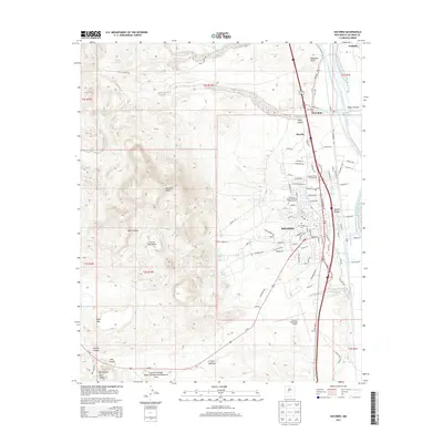
2013 Map of Socorro
USGS Topo · Published 2013About this map
Socorro and its surrounding high-desert terrain are defined by the sharp contrast between the Rio Grande valley and the formidable Socorro Mountains to the west. This 2013 survey documents a complex irrigation and water management system essential to the region, featuring the Rio Grande Main Conveyance Channel, the Socorro Riverside Drain, and various historic ditches like the Luis Lopez Ditch and Green Ditch. The presence of the National Radio Astronomy Observatory and the Socorro Municipal Airport signifies the town's role as a modern scientific and transit hub, while the BNSF Railway continues a long legacy of rail transport through the valley.
Find a feature on this map
110 named features on this map. Tap any name to fly to it.
Don’t see what you’re looking for? This feature index may not catch every label — zoom into the map to look around manually.
Map Details
Editions of this 2013 Socorro Map
This is the sole edition of this map. No revisions or reprints were ever made.
Other maps of this area

1906 · Socorro
USGS Topo · 1:62,500

1916 · La Joya
USGS Topo · 1:125,000

1948 · San Antonio
USGS Topo · 1:62,500

1954 · Tularosa
USGS Topo · 1:250,000

1954 · Socorro
USGS Topo · 1:250,000

1958 · Socorro
USGS Topo · 1:250,000

1958 · Tularosa
USGS Topo · 1:250,000

1959 · Loma De Las Canas
USGS Topo · 1:24,000

1959 · Socorro
USGS Topo · 1:24,000

1959 · Mesa Del Yeso
USGS Topo · 1:24,000