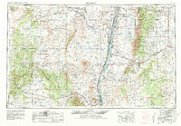
1954 Map of Socorro
USGS Topo · Published 1981About this map
Socorro and the central Rio Grande valley anchor this mid-century survey of New Mexico, capturing a landscape defined by traditional pueblos, mining districts, and volcanic geology. The Atchison Topeka and Santa Fe railroad corridor follows the river south, connecting riverbank communities like Belen, Isleta, and Lemitar. To the west, the map details the high Cebolleta Mesa and extensive Lava flows, illustrating the geological challenges faced by those traveling near Acoma Pueblo. Settlement patterns reveal the contrast between the fertile river valley and the arid uplands, where the mining village of Kelly and ranching outposts like Magdalena sit at the foot of the Magdalena Mountains. Large tracts of the Cibola National Forest and the Sandia US Mil Res further define land use in this period of regional transition.
Find a feature on this map
81 named features on this map. Tap any name to fly to it.
Don’t see what you’re looking for? This feature index may not catch every label — zoom into the map to look around manually.
Map Details
Editions of this 1954 Socorro Map
2 editions found

Other maps of this area

1883 · Mt. Taylor
USGS Topo · 1:250,000

1886 · Wingate
USGS Topo · 1:250,000

1886 · Mt. Taylor
USGS Topo · 1:250,000

1888 · Bernalillo
USGS Topo · 1:125,000

1889 · Albuquerque
USGS Topo · 1:125,000

1892 · San Pedro
USGS Topo · 1:125,000

1892 · Wingate
USGS Topo · 1:250,000

1892 · Mt. Taylor
USGS Topo · 1:250,000

1893 · Albuquerque
USGS Topo · 1:125,000

1894 · Lamy
USGS Topo · 1:125,000