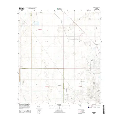
2015 Map of Socrum
USGS Topo · Published 2015About this map
Socrum serves as the focal point of this 2015 survey, marking a corner of Polk County where the landscape transitions from wetlands to agricultural and residential plots. The upper reaches of the Hillsborough River snake through the northwestern corner, while drainage patterns are further defined by features like Big Ditch and Blackwater Cr. This region, where Pasco, Hillsborough, and Polk counties meet, exhibits a patchwork of rural holdings and newer developments.
Find a feature on this map
67 named features on this map. Tap any name to fly to it.
Don’t see what you’re looking for? This feature index may not catch every label — zoom into the map to look around manually.
Map Details
Editions of this 2015 Socrum Map
This is the sole edition of this map. No revisions or reprints were ever made.
Other maps of this area

1944 · Plant City
USGS Topo · 1:31,680

1944 · Providence
USGS Topo · 1:31,680

1944 · Lakeland
USGS Topo · 1:31,680

1944 · Antioch
USGS Topo · 1:31,680

1944 · Socrum
USGS Topo · 1:31,680

1947 · Zephyrhills
USGS Topo · 1:24,000

1955 · Plant City
USGS Topo · 1:250,000

1955 · Orlando
USGS Topo · 1:250,000

1957 · Orlando
USGS Topo · 1:250,000

1958 · Orlando
USGS Topo · 1:250,000