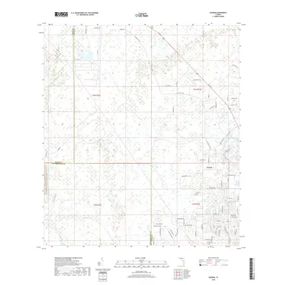
2018 Map of Socrum
USGS Topo · Published 2018About this map
Socrum sits at a crossroads of Polk, Pasco, and Hillsborough counties, anchoring a landscape where historical roadbeds meet the headwaters of central Florida drainage systems. This 2018 survey documents a region defined by its hydrography, notably the upper reaches of the Hillsborough River and the winding course of Blackwater Cr. The map reveals the persistence of early transport routes like Old Dade City Rd, which cuts diagonally across the northern sections, and the local importance of water bodies such as Indian Lake and Avenue Pond. The infrastructure suggests a transition from traditional rural routes to modern residential connectors, evidenced by the dense naming of neighborhood lanes like Sherrouse Ln and Ironhead Trl near the eastern margin. The presence of Big Ditch highlights the history of water management and land reclamation essential to the development of this tri-county borderland.
Find a feature on this map
75 named features on this map. Tap any name to fly to it.
Don’t see what you’re looking for? This feature index may not catch every label — zoom into the map to look around manually.
Map Details
Editions of this 2018 Socrum Map
This is the sole edition of this map. No revisions or reprints were ever made.
Other maps of this area

1944 · Plant City
USGS Topo · 1:31,680

1944 · Providence
USGS Topo · 1:31,680

1944 · Lakeland
USGS Topo · 1:31,680

1944 · Antioch
USGS Topo · 1:31,680

1944 · Socrum
USGS Topo · 1:31,680

1947 · Zephyrhills
USGS Topo · 1:24,000

1955 · Plant City
USGS Topo · 1:250,000

1955 · Orlando
USGS Topo · 1:250,000

1957 · Orlando
USGS Topo · 1:250,000

1958 · Orlando
USGS Topo · 1:250,000