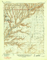
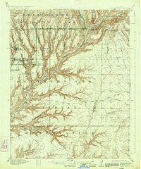
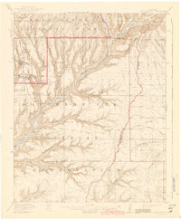
1915 Map of Soda Canyon
USGS Topo · Published 1949About this map
Mesa Verde National Park is captured in remarkable detail during the early 20th century, revealing the density of ancestral Puebloan sites across Chapin Mesa. The survey documents world-renowned structures such as Cliff Palace, Sun Temple, and Sprucetree House Headquarters before the heavy onset of modern tourism infrastructure. To the south and east, the landscape transitions into the Southern Ute Indian Reservation, where the Mancos River carves through deep canyons. The map serves as a vital record of the canyon-and-mesa topography, identifying numerous smaller dwellings like Swallows Nest and Sixteen Window House. These sites are linked by a network of primitive routes including the Government Road and the Ute Trail, which traverse the rugged divide between Soda Canyon and Moccasin Canyon.
Find a feature on this map
70 named features on this map. Tap any name to fly to it.
Don’t see what you’re looking for? This feature index may not catch every label — zoom into the map to look around manually.
Map Details
Editions of this 1915 Soda Canyon Map
7 editions found
Other maps of this area

1889 · Chaco
USGS Topo · 1:250,000

1892 · Chaco
USGS Topo · 1:250,000

1895 · La Plata
USGS Topo · 1:62,500

1897 · La Plata
USGS Topo · 1:62,500

1899 · La Plata
USGS Topo · 1:62,500

1908 · La Plata
USGS Topo · 1:62,500

1912 · Soda Canyon
USGS Topo · 1:62,500

1913 · Red Mesa
USGS Topo · 1:62,500

1915 · Soda Canyon
USGS Topo · 1:62,500

1934 · Chimney Rock
USGS Topo · 1:62,500