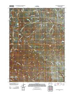
2011 Map of Soda Mountain
USGS Topo · Published 2011About this map
Soda Mountain rises prominently above a landscape defined by significant water management and high-altitude ranching along the Oregon-California border. The northern reaches of the quadrangle feature the Howard Prairie Canal and the upper reaches of Keene Creek, which support small mountain settlements like Lincoln and Mountain View. Aviation and travel infrastructure are represented by the Pinehurst State Airport and the Tubb Springs State Wayside along Route 66. To the south, the terrain becomes increasingly complex, marked by the prominent Lone Pine Ridge and the Boccard Point lookout. This area within the Rogue River National Forest is characterized by numerous small lakes and springs, such as Parsnip Lakes and Twentymile Springs, which feed into drainage systems like Skookum Creek and Dutch Oven Creek.
Find a feature on this map
42 named features on this map. Tap any name to fly to it.
Don’t see what you’re looking for? This feature index may not catch every label — zoom into the map to look around manually.
Map Details
Editions of this 2011 Soda Mountain Map
This is the sole edition of this map. No revisions or reprints were ever made.
Other maps of this area

1886 · Shasta
USGS Topo · 1:250,000

1891 · Ashland
USGS Topo · 1:250,000

1893 · Ashland
USGS Topo · 1:250,000

1894 · Shasta
USGS Topo · 1:250,000

1897 · Ashland
USGS Topo · 1:250,000

1922 · Shasta Valley Sheet No 16
USGS Topo · 1:24,000

1922 · Shasta Valley Sheet No 15
USGS Topo · 1:24,000

1932 · Yreka
USGS Topo · 1:96,000

1934 · Macdoel
USGS Topo · 1:96,000

1938 · Medford
USGS Topo · 1:125,000