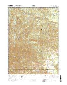
2017 Map of Soda Mountain
USGS Topo · Published 2017About this map
Soda Mountain dominates the high-altitude landscape where the Siskiyou Mountains intersect the Oregon California state line. This 2017 survey captures a region defined by its rugged topography and protected areas, notably featuring a significant section of the Pacific Crest National Scenic Trail as it winds past Hobart Bluff and Boccard Point. The map provides a detailed view of the water network feeding the Klamath Basin, including Keene Cr and the Howard Prairie Canal, alongside high-mountain water bodies like Hobart Lake and the Parsnip Lakes. Small settlements such as Lincoln and Mountain View appear along the northern highway corridor, while the Pinehurst State Airport serves as a remote aviation outpost. The southern portion of the map transitions into Agate Flat and Lone Pine Ridge, illustrating the varied terrain that local families and land managers have navigated for generations.
Find a feature on this map
54 named features on this map. Tap any name to fly to it.
Don’t see what you’re looking for? This feature index may not catch every label — zoom into the map to look around manually.
Map Details
Editions of this 2017 Soda Mountain Map
This is the sole edition of this map. No revisions or reprints were ever made.
Other maps of this area

1886 · Shasta
USGS Topo · 1:250,000

1891 · Ashland
USGS Topo · 1:250,000

1893 · Ashland
USGS Topo · 1:250,000

1894 · Shasta
USGS Topo · 1:250,000

1897 · Ashland
USGS Topo · 1:250,000

1922 · Shasta Valley Sheet No 16
USGS Topo · 1:24,000

1922 · Shasta Valley Sheet No 15
USGS Topo · 1:24,000

1932 · Yreka
USGS Topo · 1:96,000

1934 · Macdoel
USGS Topo · 1:96,000

1938 · Medford
USGS Topo · 1:125,000