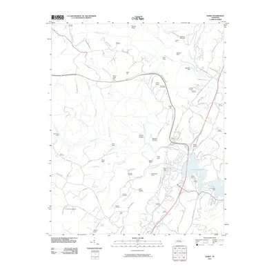
2010 Map of Soddy
USGS Topo · Published 2010About this map
The industrial and extractive history of the Cumberland Plateau is etched into this landscape north of Chattanooga. Coal mining operations define the hillsides, evidenced by the Burchard Mine, Daisy Mine, and the extensive Big Soddy Number Seven Mine complex. These operations sit alongside a dense network of family and community landmarks, such as Hotwater Cemetery and Granny Walker Cemetery, which provide vital touchstones for local genealogical research.
Find a feature on this map
112 named features on this map. Tap any name to fly to it.
Don’t see what you’re looking for? This feature index may not catch every label — zoom into the map to look around manually.
Map Details
Editions of this 2010 Soddy Map
This is the sole edition of this map. No revisions or reprints were ever made.
Other maps of this area

1888 · Chattanooga
USGS Topo · 1:125,000

1893 · Chattanooga
USGS Topo · 1:125,000

1935 · Daisy
USGS Topo · 1:24,000

1935 · Soddy
USGS Topo · 1:24,000

1935 · Snow Hill
USGS Topo · 1:24,000

1935 · Brayton
USGS Topo · 1:24,000

1935 · Mount Airy
USGS Topo · 1:24,000

1935 · Soddy Island
USGS Topo · 1:24,000
1935 · Graysville
USGS Topo · 1:24,000

1936 · Henson Gap
USGS Topo · 1:24,000