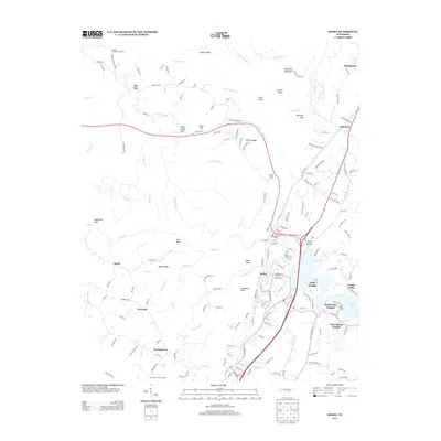
2013 Map of Soddy
USGS Topo · Published 2013About this map
Soddy and its residential expansions define the southeastern portion of this landscape, where the plateau meets the waters of Dallas Lake. The terrain is deeply incised by drainages like Big Possum Cr and Little Soddy Cr, which flow through steep gulfs including Bakewell Gulf and Mansfield Gulf. These physical barriers long dictated the placement of settlements like Flat Top and Mowbray on the higher ridges.
Find a feature on this map
170 named features on this map. Tap any name to fly to it.
Don’t see what you’re looking for? This feature index may not catch every label — zoom into the map to look around manually.
Map Details
Editions of this 2013 Soddy Map
This is the sole edition of this map. No revisions or reprints were ever made.
Other maps of this area

1888 · Chattanooga
USGS Topo · 1:125,000

1893 · Chattanooga
USGS Topo · 1:125,000

1935 · Daisy
USGS Topo · 1:24,000

1935 · Soddy
USGS Topo · 1:24,000

1935 · Snow Hill
USGS Topo · 1:24,000

1935 · Brayton
USGS Topo · 1:24,000

1935 · Mount Airy
USGS Topo · 1:24,000

1935 · Soddy Island
USGS Topo · 1:24,000
1935 · Graysville
USGS Topo · 1:24,000

1936 · Henson Gap
USGS Topo · 1:24,000