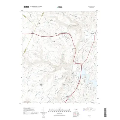
2019 Map of Soddy
USGS Topo · Published 2019About this map
Soddy-Daisy and the surrounding Hamilton County landscape are defined by the dramatic interface between the Cumberland Escarpment and the waters of Chickamauga Lake. The terrain transitions sharply from the high, plateau-like elevations of Walden Ridge and Flat Top Mountain down into the narrow hollows and valleys that feed the Tennessee River system. This transition is marked by geological features like Bakewell Gulf and Board Camp Gulf, where watercourses such as Big Possum Creek and Soddy Creek have carved deep into the sandstone.
Find a feature on this map
164 named features on this map. Tap any name to fly to it.
Don’t see what you’re looking for? This feature index may not catch every label — zoom into the map to look around manually.
Map Details
Editions of this 2019 Soddy Map
This is the sole edition of this map. No revisions or reprints were ever made.
Other maps of this area

1888 · Chattanooga
USGS Topo · 1:125,000

1893 · Chattanooga
USGS Topo · 1:125,000

1935 · Daisy
USGS Topo · 1:24,000

1935 · Soddy
USGS Topo · 1:24,000

1935 · Snow Hill
USGS Topo · 1:24,000

1935 · Brayton
USGS Topo · 1:24,000

1935 · Mount Airy
USGS Topo · 1:24,000

1935 · Soddy Island
USGS Topo · 1:24,000
1935 · Graysville
USGS Topo · 1:24,000

1936 · Henson Gap
USGS Topo · 1:24,000