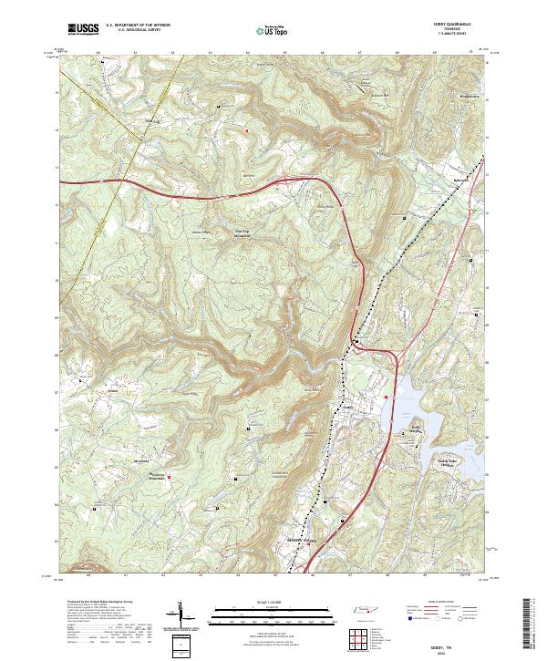
2022 Map of Soddy
USGS Topo · Published 2022About this map
Walden Ridge and the dramatic Cumberland Escarpment dominate this landscape, where the plateau drops sharply toward the Tennessee River valley. The sprawling community of Soddy-Daisy serves as the focal point of the lowland, joined by smaller settlements like Soddy, Bakewell, and Mowbray. This topography reveals the intricate relationship between the mountainous terrain and human settlement, with numerous family burial grounds such as Millsaps Cem, Granny Walker Cem, and the Soddy Presbyterian Cem dotting the ridges and hollows. The eastern edge is defined by the waters of Dallas Lake and the various branches of Soddy Creek, while the high ground features unique landmarks like the Mount Bakewell Airfield and the sharp divide of Jones Gap. Local geography is further detailed by numerous named peaks and ridges, including Flat Top Mountain and Richey Ridge.
Find a feature on this map
128 named features on this map. Tap any name to fly to it.
Don’t see what you’re looking for? This feature index may not catch every label — zoom into the map to look around manually.
Map Details
Editions of this 2022 Soddy Map
This is the sole edition of this map. No revisions or reprints were ever made.
Other maps of this area

1888 · Chattanooga
USGS Topo · 1:125,000

1893 · Chattanooga
USGS Topo · 1:125,000

1935 · Daisy
USGS Topo · 1:24,000

1935 · Soddy
USGS Topo · 1:24,000

1935 · Snow Hill
USGS Topo · 1:24,000

1935 · Brayton
USGS Topo · 1:24,000

1935 · Mount Airy
USGS Topo · 1:24,000

1935 · Soddy Island
USGS Topo · 1:24,000
1935 · Graysville
USGS Topo · 1:24,000

1936 · Henson Gap
USGS Topo · 1:24,000