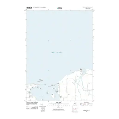
2010 Map of Sodus Point
USGS Topo · Published 2010About this map
Sodus Point sits at the northern opening of Sodus Bay, anchoring a maritime landscape defined by navigational aids and recreational boating. The Sodus Point Lighthouse, along with the Sodus Outer Light and East Pier Light, highlights the historical and modern significance of this harbor on Lake Ontario. The complex shoreline features a series of landforms including Crescent Beach and Sand Point, which shelter several islands such as Le Roy Island, Newark Island, and Eagle Island.
Find a feature on this map
34 named features on this map. Tap any name to fly to it.
Don’t see what you’re looking for? This feature index may not catch every label — zoom into the map to look around manually.
Map Details
Editions of this 2010 Sodus Point Map
This is the sole edition of this map. No revisions or reprints were ever made.
Other maps of this area

1899 · Palmyra
USGS Topo · 1:62,500

1902 · Sodus Bay
USGS Topo · 1:62,500

1902 · Pultneyville
USGS Topo · 1:62,500

1902 · Clyde
USGS Topo · 1:62,500

1902 · Palmyra
USGS Topo · 1:62,500

1943 · Sodus Point
USGS Topo · 1:31,680

1943 · Sodus
USGS Topo · 1:31,680

1943 · Wolcott
USGS Topo · 1:31,680
1943 · Rose
USGS Topo · 1:31,680
1943 · North Wolcott
USGS Topo · 1:31,680