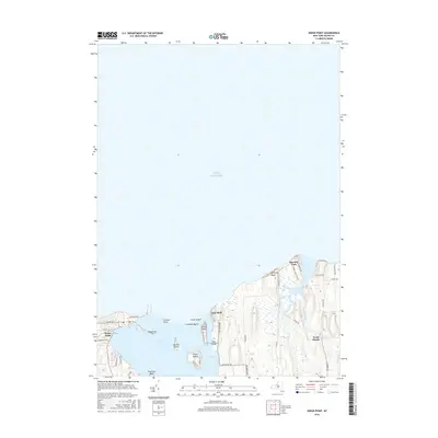
2016 Map of Sodus Point
USGS Topo · Published 2016About this map
Sodus Point anchors this coastal survey, where the deep waters of Lake Ontario meet the complex shoreline of Sodus Bay. The map highlights a series of prominent landforms and islands that define the local geography, including Charles Point, Sand Point, and the distinct elevations of Chimney Bluff and Knob Island. Further east, the small settlements of Lake Bluff and East Bay Park sit near the mouth of East Bay, while inland, the rural community of North Huron is situated near the winding course of Mudge Creek. The intricate network of islands within the bay, such as Newark Island, Eagle Island, Hog Island, and Le-Roy Island, illustrates a landscape heavily shaped by post-glacial deposition and lake levels. This 2016 record details the modern residential and recreational layout of the Wayne County shoreline, from the marinas and streets of the point to the seasonal camps and marshes like Root Swamp.
Find a feature on this map
39 named features on this map. Tap any name to fly to it.
Don’t see what you’re looking for? This feature index may not catch every label — zoom into the map to look around manually.
Map Details
Editions of this 2016 Sodus Point Map
This is the sole edition of this map. No revisions or reprints were ever made.
Other maps of this area

1899 · Palmyra
USGS Topo · 1:62,500

1902 · Sodus Bay
USGS Topo · 1:62,500

1902 · Pultneyville
USGS Topo · 1:62,500

1902 · Clyde
USGS Topo · 1:62,500

1902 · Palmyra
USGS Topo · 1:62,500

1943 · Sodus Point
USGS Topo · 1:31,680

1943 · Sodus
USGS Topo · 1:31,680

1943 · Wolcott
USGS Topo · 1:31,680
1943 · Rose
USGS Topo · 1:31,680
1943 · North Wolcott
USGS Topo · 1:31,680