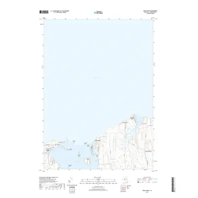
2019 Map of Sodus Point
USGS Topo · Published 2019About this map
The northern shoreline of Wayne County meets Lake Ontario in this modern survey, which details the complex interaction of barrier beaches and drumlin topography. At the western edge, the village of Sodus Point sits prominently on the peninsula separating the Great Lake from the waters of Sodus Bay. The map traces a string of landforms and islands including Sand Point, Charles Point, and Crescent Beach, which shelter the bay's internal features like Eagle Island and Newark Island.
Find a feature on this map
41 named features on this map. Tap any name to fly to it.
Don’t see what you’re looking for? This feature index may not catch every label — zoom into the map to look around manually.
Map Details
Editions of this 2019 Sodus Point Map
This is the sole edition of this map. No revisions or reprints were ever made.
Other maps of this area

1899 · Palmyra
USGS Topo · 1:62,500

1902 · Sodus Bay
USGS Topo · 1:62,500

1902 · Pultneyville
USGS Topo · 1:62,500

1902 · Clyde
USGS Topo · 1:62,500

1902 · Palmyra
USGS Topo · 1:62,500

1943 · Sodus Point
USGS Topo · 1:31,680

1943 · Sodus
USGS Topo · 1:31,680

1943 · Wolcott
USGS Topo · 1:31,680
1943 · Rose
USGS Topo · 1:31,680
1943 · North Wolcott
USGS Topo · 1:31,680