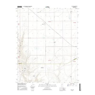
2017 Map of Solano
USGS Topo · Published 2017About this map
Solano sits at the heart of this high-plains landscape in Harding County, where the settlement pattern is defined by a sparse network of county roads and essential water sources. The community is anchored by the Solano Cem and a grid of streets including Madison St, while the surrounding terrain transitions from open ranges to a complex system of breaks and canyons. To the west and south, the land drops away into deep drainage features like Ross Canyon, Cañon Vigas, and the evocative Hole-in-the-Wall Canyon. Numerous small catchments and lakes, such as Church Lake and Goodhue Lake, dot the landscape, highlighting the critical importance of water management in this arid environment. The map also traces the jurisdictional line of the Harding Co San Miguel Co boundary, illustrating how political borders intersect with the natural topography of Mesa Cortada and Thompson Canyon.
Find a feature on this map
41 named features on this map. Tap any name to fly to it.
Don’t see what you’re looking for? This feature index may not catch every label — zoom into the map to look around manually.
Map Details
Editions of this 2017 Solano Map
This is the sole edition of this map. No revisions or reprints were ever made.
Other maps of this area

1954 · Santa Fe
USGS Topo · 1:250,000

1954 · Tucumcari
USGS Topo · 1:250,000

1958 · Santa Fe
USGS Topo · 1:250,000

1958 · Tucumcari
USGS Topo · 1:250,000

1969 · Chinaberry Canyon
USGS Topo · 1:24,000

1972 · Montoya Point
USGS Topo · 1:24,000

1972 · Waggoner Ranch
USGS Topo · 1:24,000

1973 · Mosquero
USGS Topo · 1:24,000

1973 · Sabino
USGS Topo · 1:24,000
1974 · Roy
USGS Topo · 1:24,000