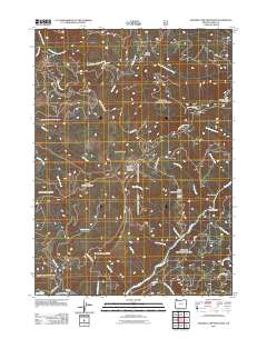
2011 Map of Soldier Camp Mountain
USGS Topo · Published 2011About this map
Soldier Camp Mountain and the surrounding drainages of the Rogue River define this portion of the Siskiyou National Forest in southwest Oregon. The landscape is characterized by a network of forest development roads, such as NFD 3340 Rd and Agness Rd, which navigate a complex topography of high ridges and deep canyons. Notable summits include Potato Illahe Mountain, Fall Mountain, and Lake of the Woods Mountain, while the lowlands features clearings like Skookumhouse Prairie, Adams Prairie, and Steffin Meadow. This modern survey illustrates the contemporary management of the timberland, showing how local access via Silver Creek Rd connects remote points like Bacon Flat to the larger river system. The presence of numerous named creeks, including Tom East Creek and Wake Up Rilea Creek, reflects a highly dissected terrain where water management and wilderness access remain central to the region's character.
Find a feature on this map
40 named features on this map. Tap any name to fly to it.
Don’t see what you’re looking for? This feature index may not catch every label — zoom into the map to look around manually.
Map Details
Editions of this 2011 Soldier Camp Mountain Map
This is the sole edition of this map. No revisions or reprints were ever made.
Other maps of this area

1899 · Port Orford
USGS Topo · 1:125,000

1903 · Port Orford
USGS Topo · 1:125,000

1954 · Coos Bay
USGS Topo · 1:250,000

1954 · Port Orford
USGS Topo · 1:62,500

1954 · Gold Beach
USGS Topo · 1:62,500

1954 · Collier Butte
USGS Topo · 1:62,500

1954 · Agness
USGS Topo · 1:62,500

1958 · Coos Bay
USGS Topo · 1:250,000

1962 · Coos Bay
USGS Topo · 1:250,000
1986 · Father Mountain
USGS Topo · 1:24,000