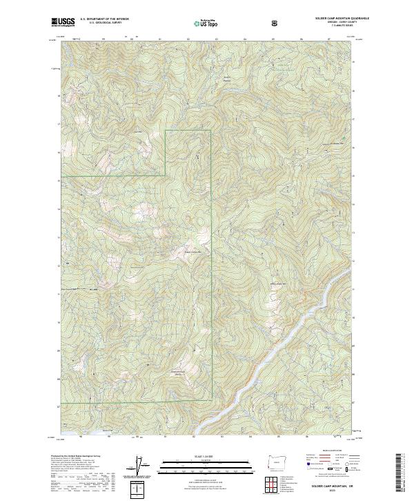
2023 Map of Soldier Camp Mountain
USGS Topo · Published 2023About this map
The Rogue Wild And Scenic River carves a deep path through this portion of the Siskiyou National Forest in Curry County. This modern survey details a succession of river features, specifically identifying numerous riffles such as Silver Creek Riffle, Rachels Delight Riffle, and Sherman Riffle. These named water features, along with the Lower Rogue River Trl, indicate the area's importance for river-based recreation and access. The terrain is defined by prominent peaks including Soldier Camp Mtn and Potato Illahe Mtn, interspersed with high-elevation clearings like Skookumhouse Prairie and Steffin Meadow. While human habitation is sparse, the presence of Bacon Flat and numerous named creeks like North Fork Lobster Creek and Auberry Creek show a landscape where topographical landmarks remain the primary identifiers for navigation and local history.
Find a feature on this map
46 named features on this map. Tap any name to fly to it.
Don’t see what you’re looking for? This feature index may not catch every label — zoom into the map to look around manually.
Map Details
Editions of this 2023 Soldier Camp Mountain Map
This is the sole edition of this map. No revisions or reprints were ever made.
Other maps of this area

1899 · Port Orford
USGS Topo · 1:125,000

1903 · Port Orford
USGS Topo · 1:125,000

1954 · Coos Bay
USGS Topo · 1:250,000

1954 · Port Orford
USGS Topo · 1:62,500

1954 · Gold Beach
USGS Topo · 1:62,500

1954 · Collier Butte
USGS Topo · 1:62,500

1954 · Agness
USGS Topo · 1:62,500

1958 · Coos Bay
USGS Topo · 1:250,000

1962 · Coos Bay
USGS Topo · 1:250,000
1986 · Father Mountain
USGS Topo · 1:24,000