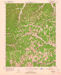
1951 Map of Soldier
USGS Topo · Published 1965About this map
The Chesapeake and Ohio railroad corridor anchors this 1951 topographic study, cutting through the southern portion of the quadrangle near the community of Soldier. This rail line served as a primary artery through the hilly terrain, connecting smaller settlements like Haldeman and Enterprise to the broader regional economy. North of the rail line, the landscape is defined by the dense, branching drainage basins of the Cumberland National Forest, where the settlement pattern follows narrow hollows and ridge lines.
Find a feature on this map
101 named features on this map. Tap any name to fly to it.
Don’t see what you’re looking for? This feature index may not catch every label — zoom into the map to look around manually.
Map Details
Editions of this 1951 Soldier Map
2 editions found
Other maps of this area

1929 · Morehead
USGS Topo · 1:48,000

1935 · Morehead
USGS Topo · 1:62,500

1950 · Head Of Grassy
USGS Topo · 1:24,000

1950 · Wesleyville
USGS Topo · 1:24,000

1950 · Olive Hill
USGS Topo · 1:24,000

1950 · Ault
USGS Topo · 1:24,000

1951 · Soldier
USGS Topo · 1:24,000

1951 · Cranston
USGS Topo · 1:24,000

1951 · Stricklett
USGS Topo · 1:24,000

1953 · Haldeman
USGS Topo · 1:24,000