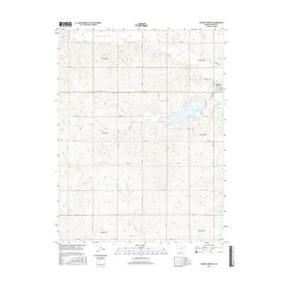
2015 Map of Soldier Creek NE
USGS Topo · Published 2015About this map
Holton serves as the primary hub in this portion of Jackson County, situated at the confluence of several local routes such as W 6th St and W 4th St. The surrounding landscape is defined by its drainage systems, including the substantial Banner Cr which feeds a large reservoir central to the map. To the north, Elk Cr meanders through the township of t6s r15e, while the southern reaches are marked by the headwaters of Little Soldier Cr and Crow Cr. These watercourses have long dictated the placement of rural roads and property lines. For those tracing family histories in the area, the map preserves the locations of Holton Cem and the smaller Hass Cem, situated along Nicole Rd north of the main settlement. The survey illustrates a transition from the structured street grid of the town to the sprawling section lines of the Kansas prairie.
Find a feature on this map
30 named features on this map. Tap any name to fly to it.
Don’t see what you’re looking for? This feature index may not catch every label — zoom into the map to look around manually.
Map Details
Editions of this 2015 Soldier Creek NE Map
This is the sole edition of this map. No revisions or reprints were ever made.
Other maps of this area

1888 · Hiawatha
USGS Topo · 1:125,000

1889 · Topeka
USGS Topo · 1:125,000

1894 · Topeka
USGS Topo · 1:125,000

1894 · Hiawatha
USGS Topo · 1:125,000

1950 · Kansas City
USGS Topo · 1:250,000

1954 · Kansas City
USGS Topo · 1:250,000

1956 · Kansas City
USGS Topo · 1:250,000

1960 · Kansas City
USGS Topo · 1:250,000
1960 · Mayetta
USGS Topo · 1:24,000
1960 · Holton
USGS Topo · 1:24,000