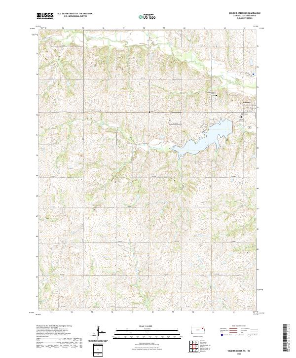
2022 Map of Soldier Creek NE
USGS Topo · Published 2022About this map
The town of Holton serves as the focal point of this Jackson County survey, situated at the eastern edge of a landscape defined by its rolling drainages and rural sections. The township lines for t6s r14e, t7s r15e, and others provide the framework for a network of section roads like 214th RD and 190th RD. Significant local history and genealogy markers are scattered throughout the countryside, including the Mount Calvary Catholic Cem, Haas Cem, and the larger Holton Cem near the city center.
Find a feature on this map
32 named features on this map. Tap any name to fly to it.
Don’t see what you’re looking for? This feature index may not catch every label — zoom into the map to look around manually.
Map Details
Editions of this 2022 Soldier Creek NE Map
This is the sole edition of this map. No revisions or reprints were ever made.
Other maps of this area

1888 · Hiawatha
USGS Topo · 1:125,000

1889 · Topeka
USGS Topo · 1:125,000

1894 · Topeka
USGS Topo · 1:125,000

1894 · Hiawatha
USGS Topo · 1:125,000

1950 · Kansas City
USGS Topo · 1:250,000

1954 · Kansas City
USGS Topo · 1:250,000

1956 · Kansas City
USGS Topo · 1:250,000

1960 · Kansas City
USGS Topo · 1:250,000
1960 · Mayetta
USGS Topo · 1:24,000
1960 · Holton
USGS Topo · 1:24,000