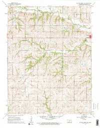
1960 Map of Soldier Creek NE
USGS Topo · Published 1962About this map
Holton anchors the eastern edge of this Kansas landscape, where the town's grid meets the undulating drainage basins of Jackson County. A significant historical marker, the Old Potawatomi Indian Reservation Boundary, bisects the lower third of the quadrangle, providing a vital spatial reference for the 19th-century land divisions of the region. The map reveals a rural society structured by township lines, including Jefferson, Liberty, and Banner. Local landmarks such as Banner School and the Hass Cemetery are situated among the watersheds of Banner Creek and Little Soldier Creek. This 1960 era survey documents the persistence of the small-plot agricultural layout and the specific placement of rural institutions before later 20th-century consolidations altered the local geography.
Find a feature on this map
13 named features on this map. Tap any name to fly to it.
Don’t see what you’re looking for? This feature index may not catch every label — zoom into the map to look around manually.
Map Details
Editions of this 1960 Soldier Creek NE Map
This is the sole edition of this map. No revisions or reprints were ever made.
Other maps of this area

1888 · Hiawatha
USGS Topo · 1:125,000

1889 · Topeka
USGS Topo · 1:125,000

1894 · Topeka
USGS Topo · 1:125,000

1894 · Hiawatha
USGS Topo · 1:125,000

1950 · Kansas City
USGS Topo · 1:250,000

1954 · Kansas City
USGS Topo · 1:250,000

1956 · Kansas City
USGS Topo · 1:250,000

1960 · Kansas City
USGS Topo · 1:250,000
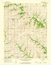
1960 · Mayetta
USGS Topo · 1:24,000
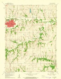
1960 · Holton
USGS Topo · 1:24,000