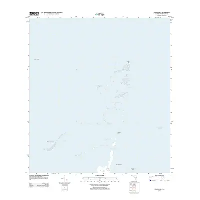
2012 Map of Soldier Key
USGS Topo · Published 2012About this map
Soldier Key and the northern reaches of the Biscayne archipelago stand at the interface of the Atlantic Ocean and Biscayne Bay. This 2012 survey details the complex maritime landscape of Miami-Dade County, focusing on the small islands and underwater hazards that have long dictated navigation in these tropical waters. The map highlights the narrow pass known as The Keyhole at the northern tip of Sands Key, adjacent to Boca Chita Key. To the north, the chain continues through the Ragged Keys toward the distinctive Safety Valve flats. Significant shoals and submerged features such as Featherbed Bank, Black Ledge, and Bowles Bank define the local hydrography, illustrating the shallow, shifting nature of the bay floor during the early 21st century.
Find a feature on this map
12 named features on this map. Tap any name to fly to it.
Don’t see what you’re looking for? This feature index may not catch every label — zoom into the map to look around manually.
Map Details
Editions of this 2012 Soldier Key Map
This is the sole edition of this map. No revisions or reprints were ever made.
Other maps of this area

1947 · Key Biscayne
USGS Topo · 1:24,000

1948 · Soldier Key
USGS Topo · 1:24,000

1949 · Elliott Key
USGS Topo · 1:24,000

1949 · Key Biscayne
USGS Topo · 1:24,000

1949 · Arsenicker Keys
USGS Topo · 1:24,000

1949 · Perrine
USGS Topo · 1:24,000

1950 · South Miami
USGS Topo · 1:24,000
1956 · Elliott Key
USGS Topo · 1:24,000

1956 · Perrine
USGS Topo · 1:24,000

1956 · South Miami
USGS Topo · 1:24,000