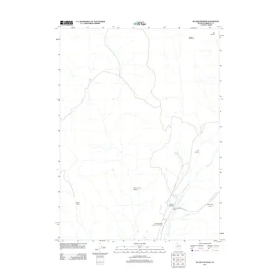
2011 Map of Soldier Meadow
USGS Topo · Published 2011About this map
Soldier Meadow Ranch stands as a focal point in this high-desert landscape of Humboldt County, where water sources dictate the patterns of settlement and travel. The intersection of Co RD 217 and Leonard Creek Rd provides the primary access through this arid terrain, linking the ranch and the nearby Soldier Meadow Number One Airport to the broader region. The drainage network is well-defined by Soldier Creek, Slumgullion Creek, and Mud Meadow Creek, which draw from the surrounding heights of Trough Mountain. Deep topographic relief is evident in the numerous incisions of Warm Springs Canyon, White Rock Canyon, and Chukar Gulch. Reliable water points such as Clear Springs and Antelope Springs appear as critical landmarks for anyone navigating this portion of the Great Basin, reflecting a classic Western landscape of isolated outposts and seasonal watercourses.
Find a feature on this map
15 named features on this map. Tap any name to fly to it.
Don’t see what you’re looking for? This feature index may not catch every label — zoom into the map to look around manually.
Map Details
Editions of this 2011 Soldier Meadow Map
This is the sole edition of this map. No revisions or reprints were ever made.
Other maps of this area

1889 · Long Valley
USGS Topo · 1:250,000

1954 · Vya
USGS Topo · 1:250,000

1958 · Vya
USGS Topo · 1:250,000

1962 · Vya
USGS Topo · 1:250,000

1965 · Rock Spring Table
USGS Topo · 1:62,500

1966 · Badger Mtn SE
USGS Topo · 1:24,000

1972 · Mud Meadow
USGS Topo · 1:24,000

1972 · Soldier Meadow
USGS Topo · 1:24,000

1972 · High Rock Lake
USGS Topo · 1:24,000

1972 · Big Mountain
USGS Topo · 1:24,000