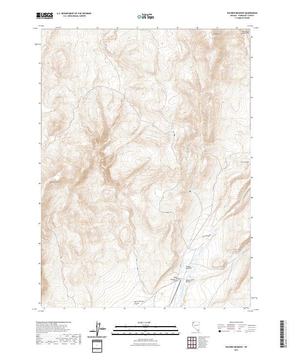
2021 Map of Soldier Meadow
USGS Topo · Published 2021About this map
Soldier Meadow serves as the central focal point of this high-desert landscape in Humboldt County, where water resources dictate the patterns of human and natural activity. The map reveals a network of perennial and seasonal drainages, including the notable Mud Meadow Cr and Soldier Cr, which carve through the volcanic topography. Remote aviation access is provided by the Soldier Meadow Number 1 Airport, situated near the confluence of White Rock Canyon and the surrounding flats. The presence of Clear Springs and Antelope Springs highlights the critical importance of reliable water sources in this arid environment. Significant elevation changes are marked by Trough Mtn and the High Rock Canyon Hills, while names like Chukar Gulch suggest the local wildlife and hunting culture of the Great Basin.
Find a feature on this map
19 named features on this map. Tap any name to fly to it.
Don’t see what you’re looking for? This feature index may not catch every label — zoom into the map to look around manually.
Map Details
Editions of this 2021 Soldier Meadow Map
This is the sole edition of this map. No revisions or reprints were ever made.
Other maps of this area

1889 · Long Valley
USGS Topo · 1:250,000

1954 · Vya
USGS Topo · 1:250,000

1958 · Vya
USGS Topo · 1:250,000

1962 · Vya
USGS Topo · 1:250,000

1965 · Rock Spring Table
USGS Topo · 1:62,500

1966 · Badger Mtn SE
USGS Topo · 1:24,000

1972 · Mud Meadow
USGS Topo · 1:24,000

1972 · Soldier Meadow
USGS Topo · 1:24,000

1972 · High Rock Lake
USGS Topo · 1:24,000

1972 · Big Mountain
USGS Topo · 1:24,000