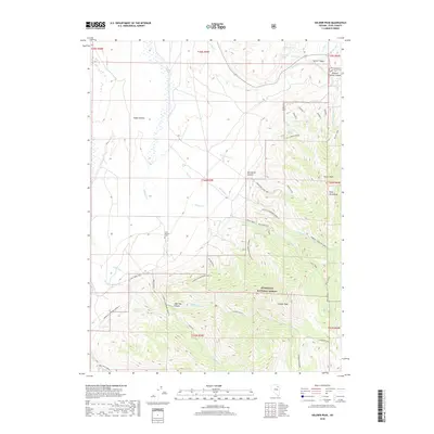
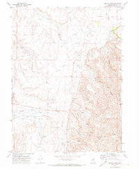
2018 Map of Soldier Peak
USGS Topo · Published 2018About this map
Fort Halleck Cem sits at the base of the Ruby Mountains, serving as a silent anchor for local history in this high-altitude corner of Elko County. The landscape is defined by the sharp transition from the open desert floor to the high peaks of the Humboldt National Forest, where steep drainages like John Day Canyon and Starvation Canyon provide vital water sources. Named springs such as Emigrant Spring, Hoot Owl Spring, and Warm Spring point to the critical role of water for travelers and ranchers in this arid environment.
Find a feature on this map
54 named features on this map. Tap any name to fly to it.
Don’t see what you’re looking for? This feature index may not catch every label — zoom into the map to look around manually.
Map Details
Editions of this 2018 Soldier Peak Map
This is the sole edition of this map. No revisions or reprints were ever made.
Other maps of this area

1935 · Halleck
USGS Topo · 1:125,000

1955 · Elko
USGS Topo · 1:250,000

1958 · Elko
USGS Topo · 1:250,000

1962 · Elko
USGS Topo · 1:250,000

1962 · Lamoille
USGS Topo · 1:62,500

1965 · Elko
USGS Topo · 1:250,000
1969 · Secret Valley
USGS Topo · 1:24,000
1969 · Tent Mountain
USGS Topo · 1:24,000
1970 · Soldier Peak
USGS Topo · 1:24,000
1971 · Heelfly Creek
USGS Topo · 1:24,000