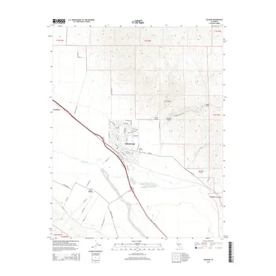
2015 Map of Soledad
USGS Topo · Published 2015About this map
The city of Soledad sits at the heart of the fertile Salinas Valley, where residential street grids like Santa Lucia Dr and Monterey St meet the agricultural expanse. To the southwest, the Salinas River carves a wide, braided path through the landscape, flanked by the settlement of Fort Romie. This area reflects a long history of land division, clearly marked by the Public Land Survey System township boundaries including t16s r6e and t17s r6e. To the north and east, the terrain rises into the foothills, where deep drainages like Stonewall Canyon and Bryant Canyon cut through the rising elevation. Smaller outposts like Camphora to the northwest and Harlem to the southeast are connected by major transit corridors and local routes such as Metz Rd, while the Soledad Cemetery remains a fixed point of local heritage on the town's eastern edge.
Find a feature on this map
61 named features on this map. Tap any name to fly to it.
Don’t see what you’re looking for? This feature index may not catch every label — zoom into the map to look around manually.
Map Details
Editions of this 2015 Soledad Map
This is the sole edition of this map. No revisions or reprints were ever made.
Other maps of this area

1910 · Gonzales
USGS Topo · 1:31,680

1910 · Soledad
USGS Topo · 1:31,680

1912 · Metz
USGS Topo · 1:31,680

1915 · Soledad
USGS Topo · 1:62,500

1919 · San Benito
USGS Topo · 1:62,500

1921 · Gonzales
USGS Topo · 1:62,500

1921 · Metz
USGS Topo · 1:62,500

1931 · San Benito
USGS Topo · 1:62,500

1940 · Metz
USGS Topo · 1:62,500

1940 · Soledad
USGS Topo · 1:62,500