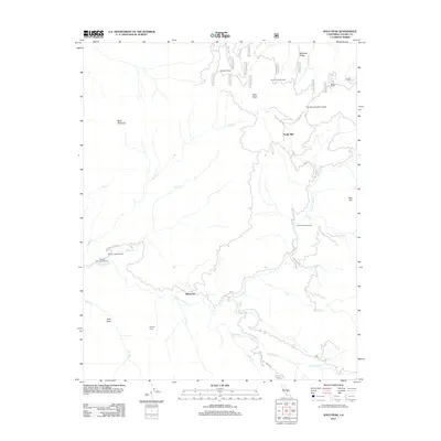
2012 Map of Solo Peak
USGS Topo · Published 2012About this map
The S Fork Tule River carves through this high-altitude landscape in eastern California, anchoring a region defined by tribal lands and historic timber operations. Within the Tule River Indian Lands, the map reveals a network of remote outposts and forest infrastructure, including Redwood Camp, Simmons Post Camp, and Rogers Camp. Industrial history is preserved through labels for the Pigeon Creek Sawmill and Smith Mill, indicating the long-standing role of the forest in the local economy. From the heights of Solo Peak and Black Mountain, the drainage system of Pigeon Creek and Kessing Creek flows toward the river valley. The small settlement at Wheatons serves as a modern waypoint amidst several recreational sites like Painted Rock Campground and Cholollo Campground, where the Cholollo Falls mark a significant hydraulic feature of the river's descent.
Find a feature on this map
40 named features on this map. Tap any name to fly to it.
Don’t see what you’re looking for? This feature index may not catch every label — zoom into the map to look around manually.
Map Details
Editions of this 2012 Solo Peak Map
This is the sole edition of this map. No revisions or reprints were ever made.
Other maps of this area

1904 · Kaweah
USGS Topo · 1:125,000

1909 · Kaweah
USGS Topo · 1:125,000

1936 · White River
USGS Topo · 1:62,500

1936 · Tobias Peak
USGS Topo · 1:125,000

1937 · Kaweah
USGS Topo · 1:125,000

1943 · Tobias Peak
USGS Topo · 1:125,000

1945 · Tobias Peak
USGS Topo · 1:62,500

1948 · Bakersfield
USGS Topo · 1:250,000

1948 · Fresno
USGS Topo · 1:250,000
1952 · White River
USGS Topo · 1:62,500