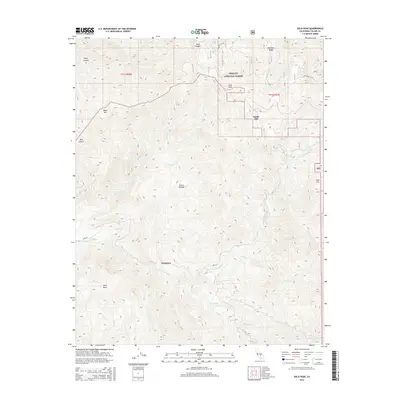
2015 Map of Solo Peak
USGS Topo · Published 2015About this map
Wheatons and Smith Mill represent the primary points of human interest in this high-altitude landscape within the Sequoia National Forest. The topography is dominated by the steep drainages of the Sierra Nevada, where the S Fork Tule River and numerous tributaries like Kessing Cr, Pigeon Cr, and Bear Cr carve through deep canyons. Notable summits such as Solo Peak and Black Mtn rise above the complex network of ridges, including Bateman Ridge in the northeast. The presence of Cholollo Falls and Slick Rock indicates the dramatic water-carved granite features characteristic of this region. Mapping of Forest Rte 21S12 and Forest Rte 21S94 provides a record of the infrastructure supporting forest management and recreational access in this part of Tulare County.
Find a feature on this map
31 named features on this map. Tap any name to fly to it.
Don’t see what you’re looking for? This feature index may not catch every label — zoom into the map to look around manually.
Map Details
Editions of this 2015 Solo Peak Map
This is the sole edition of this map. No revisions or reprints were ever made.
Other maps of this area

1904 · Kaweah
USGS Topo · 1:125,000

1909 · Kaweah
USGS Topo · 1:125,000

1936 · White River
USGS Topo · 1:62,500

1936 · Tobias Peak
USGS Topo · 1:125,000

1937 · Kaweah
USGS Topo · 1:125,000

1943 · Tobias Peak
USGS Topo · 1:125,000

1945 · Tobias Peak
USGS Topo · 1:62,500

1948 · Bakersfield
USGS Topo · 1:250,000

1948 · Fresno
USGS Topo · 1:250,000
1952 · White River
USGS Topo · 1:62,500