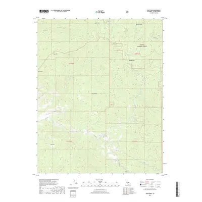
2018 Map of Solo Peak
USGS Topo · Published 2018About this map
Sequoia National Forest encompasses the majority of this high-elevation landscape, where the S Fork Tule River carves a deep path through the Sierra Nevada mountains. The terrain is defined by prominent peaks and ridges, including the namesake Solo Peak, Black Mtn, and Bateman Ridge. Historically, the area shows evidence of early industry and habitation at locations such as Smith Mill and the Sierra Nevada settlement area.
Find a feature on this map
36 named features on this map. Tap any name to fly to it.
Don’t see what you’re looking for? This feature index may not catch every label — zoom into the map to look around manually.
Map Details
Editions of this 2018 Solo Peak Map
This is the sole edition of this map. No revisions or reprints were ever made.
Other maps of this area

1904 · Kaweah
USGS Topo · 1:125,000

1909 · Kaweah
USGS Topo · 1:125,000

1936 · White River
USGS Topo · 1:62,500

1936 · Tobias Peak
USGS Topo · 1:125,000

1937 · Kaweah
USGS Topo · 1:125,000

1943 · Tobias Peak
USGS Topo · 1:125,000

1945 · Tobias Peak
USGS Topo · 1:62,500

1948 · Bakersfield
USGS Topo · 1:250,000

1948 · Fresno
USGS Topo · 1:250,000
1952 · White River
USGS Topo · 1:62,500