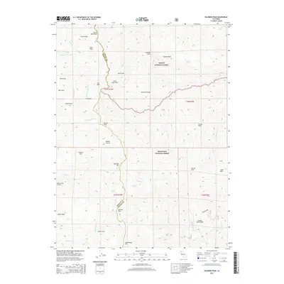
2015 Map of Solomon Peak
USGS Topo · Published 2015About this map
Solomon Peak and the surrounding wilderness of the North Coast Ranges are documented in this 2015 survey, which straddles the boundary between the Trinity National Forest and Mendocino National Forest. The landscape is defined by the headwaters of the Middle Fork Eel River and Thomes Creek, featuring high-elevation points such as Hammerhorn Mountain and Sugarloaf Mountain. The terrain transitions from deep ravines like Devils Hole Gulch to isolated water sources such as Kingsley Lake and Minnie Lake. Genealogists and historians can trace family-named landmarks like Harvey Ridge and Hopkins Hollow, which reflect the early ranching and surveying history of the border between Trinity and Tehama counties. The map also identifies distinctive natural features like the volcanic-sounding Hole-in-the-Ground and mineral-rich Sulphur Spring.
Find a feature on this map
48 named features on this map. Tap any name to fly to it.
Don’t see what you’re looking for? This feature index may not catch every label — zoom into the map to look around manually.
Map Details
Editions of this 2015 Solomon Peak Map
This is the sole edition of this map. No revisions or reprints were ever made.
Other maps of this area

1890 · Red Bluff
USGS Topo · 1:250,000

1894 · Red Bluff
USGS Topo · 1:250,000

1926 · Covelo
USGS Topo · 1:62,500

1931 · Hoaglin
USGS Topo · 1:96,000

1935 · Hoaglin
USGS Topo · 1:125,000

1952 · Covelo
USGS Topo · 1:62,500

1952 · Anthony Peak
USGS Topo · 1:62,500

1953 · Blackrock Mtn
USGS Topo · 1:62,500

1954 · Blackrock Mtn
USGS Topo · 1:62,500

1954 · Yolla Bolly
USGS Topo · 1:62,500