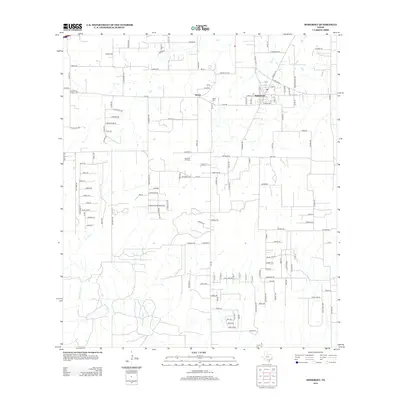
2013 Map of Somerset
USGS Topo · Published 2013About this map
The Somerset Oil Field anchors the economy and landscape of this corner of Bexar County, where traditional ranching and rural industry intersect. The town of Somerset and the nearby settlement of Bexar serve as the primary hubs for the surrounding road network, which is defined by routes like Fm-2790 and Briggs Rd. This map captures a landscape shaped by petroleum extraction and long-standing local families, with names like Luckey Rd and S McConnell Rd marking the property lines and farm-to-market connections of the region.
Find a feature on this map
134 named features on this map. Tap any name to fly to it.
Don’t see what you’re looking for? This feature index may not catch every label — zoom into the map to look around manually.
Map Details
Editions of this 2013 Somerset Map
This is the sole edition of this map. No revisions or reprints were ever made.
Other maps of this area

1942 · Natalia
USGS Topo · 1:62,500

1953 · Terrell Wells
USGS Topo · 1:24,000

1953 · Macdona
USGS Topo · 1:24,000

1954 · San Antonio
USGS Topo · 1:250,000

1957 · San Antonio
USGS Topo · 1:250,000

1958 · La Coste
USGS Topo · 1:24,000

1958 · Somerset
USGS Topo · 1:24,000

1958 · Thelma
USGS Topo · 1:24,000
1964 · Lytle
USGS Topo · 1:24,000
1964 · Bigfoot
USGS Topo · 1:24,000