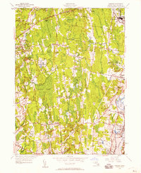
1948 Map of Somerset
USGS Topo · Published 1958About this map
The Taunton River serves as the primary eastern boundary for this region of Bristol County, where the industrial and residential development of Somerset and Dighton meets a landscape of expansive wetlands. Inland, the topography is defined by significant swamp systems including Manwhague Swamp and Bad Luck Swamp, which separate the riverfront settlements from the rural western townships. The 1948 revision of this survey shows the established neighborhoods of Pottersville and North Dighton, while the interior remains a web of smaller crossroads and historic sites like Hornbine Ch and the Swansea Factory. Local landmarks such as the Taunton Dog Track and the Somerset Pumping Sta near Broad Cove illustrate the varied land use of the mid-century period, balancing recreational needs and public infrastructure with the traditional agriculture of the Massachusetts coast.
Find a feature on this map
85 named features on this map. Tap any name to fly to it.
Don’t see what you’re looking for? This feature index may not catch every label — zoom into the map to look around manually.
Map Details
Editions of this 1948 Somerset Map
2 editions found
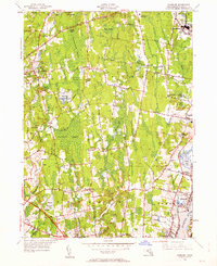
Other maps of this area

1885 · Taunton
USGS Topo · 1:62,500

1887 · Providence
USGS Topo · 1:62,500

1888 · Fall River
USGS Topo · 1:62,500

1888 · Taunton
USGS Topo · 1:62,500

1889 · Providence
USGS Topo · 1:62,500

1890 · Narragansett Bay
USGS Topo · 1:62,500

1892 · Narragansett Bay
USGS Topo · 1:62,500

1893 · Taunton
USGS Topo · 1:62,500

1893 · Fall River
USGS Topo · 1:62,500

1894 · Providence
USGS Topo · 1:62,500