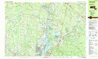
1985 Map of Somerset
USGS Topo · Published 1985About this map
Taunton River and Assonet River dominate the landscape of Bristol County in the mid-1980s, serving as the geographic anchors for settlements like Somerset and Dighton. The convergence of these waters at Assonet Bay highlights a region defined by its tidal access and industrial heritage, with the Conrail lines tracing the eastern corridor. Cultural and conservation landmarks are prominent, from the protected acreage of the Freetown Fall River State Forest and Berkley State Forest to historical sites such as Dighton Rock State Park. Educational and religious foundations of the community are well-documented, including the Old Quaker Cem, St Bernards Ch, and the Dighton-Rehoboth Regional High Sch. The map also captures several distinct neighborhood corners and plains, such as Chestnut Tree Corner and the Manwhague Plain, illustrating the late-century transition of traditional New England townships.
Find a feature on this map
107 named features on this map. Tap any name to fly to it.
Don’t see what you’re looking for? This feature index may not catch every label — zoom into the map to look around manually.
Map Details
Editions of this 1985 Somerset Map
2 editions found
Other maps of this area

1885 · New Bedford
USGS Topo · 1:62,500

1885 · Middleboro
USGS Topo · 1:62,500

1885 · Taunton
USGS Topo · 1:62,500

1887 · Providence
USGS Topo · 1:62,500

1888 · New Bedford
USGS Topo · 1:62,500

1888 · Fall River
USGS Topo · 1:62,500

1888 · Taunton
USGS Topo · 1:62,500

1888 · Middleboro
USGS Topo · 1:62,500

1889 · Providence
USGS Topo · 1:62,500

1890 · Narragansett Bay
USGS Topo · 1:62,500