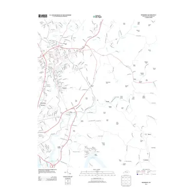
2013 Map of Somerset
USGS Topo · Published 2013About this map
Ferguson and the southern reaches of the Pulaski County seat area define the landscape of this 2013 survey. The terrain is characterized by a dense concentration of knobs and hollows, including Jones Knob and Thunder Struck Knob, which rise above the drainages of Pitman Cr and Sinking Cr. To the southwest, the waters of Lake Cumberland reach into the valleys at River Hollow, marking the influence of the region's major reservoir on local geography. Small settlements and named crossroads such as Elihu, Alcalde, and Ruth are connected by a network of rural routes like Old London Rd and Old Alcalde Rd. The presence of the Lake Cumberland Regional Airport and industrial areas along Lumber Dr reflect the modern infrastructure of the early 21st century, while family names preserved on landmarks and corridors like Albert Baker Rd and Massey Cemetery Rd provide significant data for local history and genealogical research.
Find a feature on this map
87 named features on this map. Tap any name to fly to it.
Don’t see what you’re looking for? This feature index may not catch every label — zoom into the map to look around manually.
Map Details
Editions of this 2013 Somerset Map
This is the sole edition of this map. No revisions or reprints were ever made.
Other maps of this area

1890 · Williamsburg
USGS Topo · 1:125,000

1893 · London
USGS Topo · 1:125,000

1894 · Williamsburg
USGS Topo · 1:125,000

1897 · London
USGS Topo · 1:125,000

1932 · Burnside
USGS Topo · 1:62,500

1935 · Somerset
USGS Topo · 1:62,500

1952 · Hail
USGS Topo · 1:24,000

1952 · Dykes
USGS Topo · 1:24,000

1952 · Shopville
USGS Topo · 1:24,000

1953 · Frazer
USGS Topo · 1:24,000