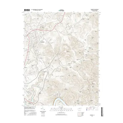
2016 Map of Somerset
USGS Topo · Published 2016About this map
Somerset serves as the central hub of this Pulaski County landscape, where urban street grids transition into a dissected plateau of named knobs and hollows. The city's southward expansion is visible through Ferguson and Elihu, eventually reaching the northern shores of Lake Cumberland. This 2016 survey captures the area's intricate topographical character, featuring dozens of named elevations like Thunder Struck Knob and Lick Skillet Knob. The presence of numerous small family and community burial grounds, such as Dutton Cem and Brown Cem, provides a detailed record of the region's rural genealogy. Along the southern edge, the map documents the critical intersection of land and water at Burnside, where the Cumberland Lake shoreline shapes the local geography. Significant infrastructure, including the Lake Cumberland Regional Airport and Somerset Community Coll, underscores the area's modern development alongside traditional settlements like Alcalde and Meece.
Find a feature on this map
190 named features on this map. Tap any name to fly to it.
Don’t see what you’re looking for? This feature index may not catch every label — zoom into the map to look around manually.
Map Details
Editions of this 2016 Somerset Map
This is the sole edition of this map. No revisions or reprints were ever made.
Other maps of this area

1890 · Williamsburg
USGS Topo · 1:125,000

1893 · London
USGS Topo · 1:125,000

1894 · Williamsburg
USGS Topo · 1:125,000

1897 · London
USGS Topo · 1:125,000

1932 · Burnside
USGS Topo · 1:62,500

1935 · Somerset
USGS Topo · 1:62,500

1952 · Hail
USGS Topo · 1:24,000

1952 · Dykes
USGS Topo · 1:24,000

1952 · Shopville
USGS Topo · 1:24,000

1953 · Frazer
USGS Topo · 1:24,000