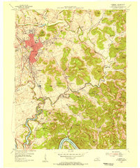
1954 Map of Somerset
USGS Topo · Published 1956About this map
Somerset serves as the focal point of this mid-century Kentucky landscape, showing a period of significant urban development alongside the Southern railroad line. The city's growth is evidenced by numerous public buildings, including the City Hospital, Armory, and Central Sch, while the adjacent Ferguson rail hub highlights the area's transportation importance. To the south, the recently formed Lake Cumberland and the Cumberland River snake through a terrain defined by dozens of family-named peaks such as Denny Knob and Thunder Struck Knob. The rural areas are densely populated with small institutions like the Rush Branch Sch and Peoples Chapel, indicating a deeply rooted community structure. Many of these landmarks, particularly the numerous country schools and cemeteries like Bradley Chapel Cem, provide essential data for tracing family histories in the Pulaski County countryside.
Find a feature on this map
97 named features on this map. Tap any name to fly to it.
Don’t see what you’re looking for? This feature index may not catch every label — zoom into the map to look around manually.
Map Details
Editions of this 1954 Somerset Map
This is the sole edition of this map. No revisions or reprints were ever made.
Other maps of this area

1890 · Williamsburg
USGS Topo · 1:125,000

1893 · London
USGS Topo · 1:125,000

1894 · Williamsburg
USGS Topo · 1:125,000

1897 · London
USGS Topo · 1:125,000

1932 · Burnside
USGS Topo · 1:62,500

1935 · Somerset
USGS Topo · 1:62,500

1952 · Hail
USGS Topo · 1:24,000

1952 · Dykes
USGS Topo · 1:24,000

1952 · Shopville
USGS Topo · 1:24,000

1953 · Frazer
USGS Topo · 1:24,000