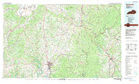
1982 Map of Somerset
USGS Topo · Published 1983About this map
Lake Cumberland and the South Fork Cumberland River dominate the southern landscape of this 1980s-era survey, where the expanding waters meet the steep topography of the Cumberland Plateau. The regional hub of Somerset serves as a focal point for transport, situated near the Univ of Ky Community College and the junction of major routes like U.S. 27. To the east, the Daniel Boone National Forest preserves a labyrinth of ridges such as Boone Ridge and Hindsfield Ridge.
Find a feature on this map
216 named features on this map. Tap any name to fly to it.
Don’t see what you’re looking for? This feature index may not catch every label — zoom into the map to look around manually.
Map Details
Editions of this 1982 Somerset Map
This is the sole edition of this map. No revisions or reprints were ever made.
Other maps of this area

1886 · Cumberland Gap
USGS Topo · 1:125,000

1888 · Cumberland Gap
USGS Topo · 1:125,000

1890 · Williamsburg
USGS Topo · 1:125,000

1891 · Manchester
USGS Topo · 1:125,000

1891 · Cumberland Gap
USGS Topo · 1:125,000

1892 · Richmond
USGS Topo · 1:125,000

1892 · Beattyville
USGS Topo · 1:125,000

1893 · London
USGS Topo · 1:125,000

1894 · Williamsburg
USGS Topo · 1:125,000

1897 · Richmond
USGS Topo · 1:125,000