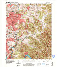
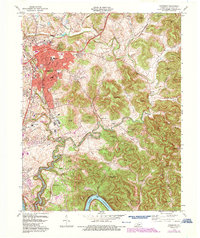
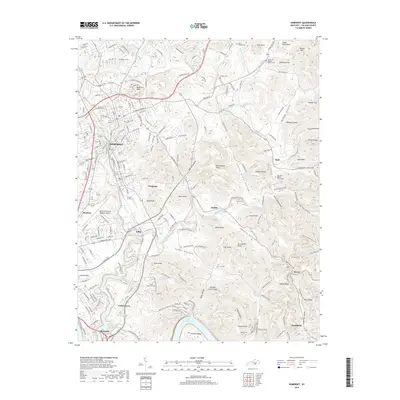
1997 Map of Somerset
USGS Topo · Published 2000About this map
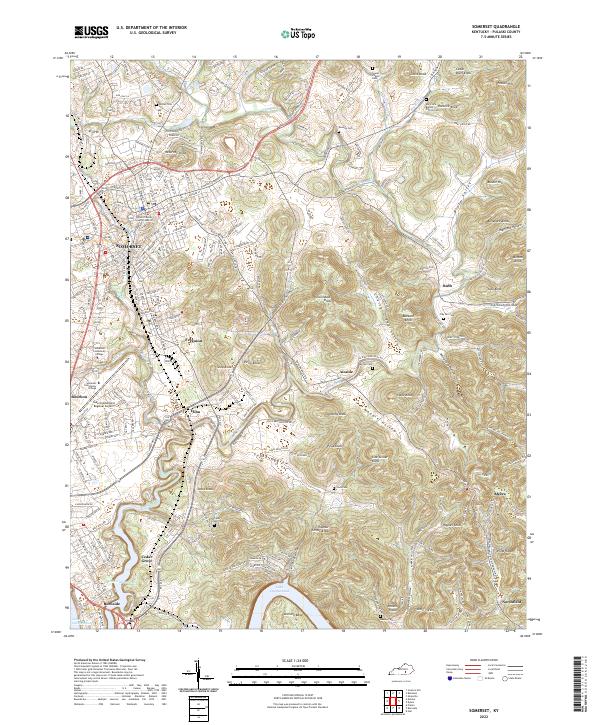
The Somerset municipal area dominates the northwestern portion of this landscape, showing a dense residential and commercial grid that includes the University of Ky Community College and Somerset-Pulaski Co J T Wilson Field. The terrain drops sharply toward the south and east into a labyrinth of narrow valleys and high ridges, including Thunder Struck Knob and Lick Skillet Knob. This topography dictates the settlement patterns, as seen in the small communities of Elihu and Alcalde which follow the winding corridors between the hills. In the south, the deep waters of Lake Cumberland fill the river valley, bordering the community of Burnside. The Southern railway line provides a clear industrial axis, cutting through the terrain and connecting the city to the smaller outlying hamlets. Landmark buildings like the Armory and City Hall ground the urban center, while rural life is marked by numerous family and community landmarks like Peoples Chapel and Antioch Church.
Find a feature on this map
82 named features on this map. Tap any name to fly to it.
Don’t see what you’re looking for? This feature index may not catch every label — zoom into the map to look around manually.
Map Details
Editions of this 1997 Somerset Map
This is the sole edition of this map. No revisions or reprints were ever made.
Historical Maps of Somerset Through Time
11 maps found
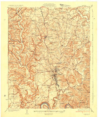
1935 Somerset
Pulaski County, KY
1954 Somerset
Pulaski County, KY
1961 Somerset
Pulaski County, KY
1973 Somerset
Pulaski County, KY

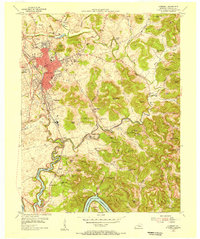
1982 Somerset
Pulaski County, KY
1997 Somerset
Pulaski County, KY
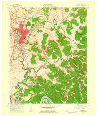
2010 Somerset
Pulaski County, KY
2013 Somerset
Pulaski County, KY
2016 Somerset
Pulaski County, KY
2019 Somerset
Pulaski County, KY
2022 Somerset
Pulaski County, KY