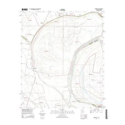
2015 Map of Somerset
USGS Topo · Published 2015About this map
The low-lying alluvial plains at the border of Louisiana and Mississippi are defined by the dramatic loops of the Mississippi River and its former channels. Somerset and Hurricane anchor a landscape heavily shaped by oxbow lakes and wetlands, including Palmyra Lake and Grassy Lake. This terrain is crisscrossed by specialized agricultural roads like Turnrow and Turn-Row, which trace the intensive farming operations typical of the Mississippi Delta.
Find a feature on this map
43 named features on this map. Tap any name to fly to it.
Don’t see what you’re looking for? This feature index may not catch every label — zoom into the map to look around manually.
Map Details
Editions of this 2015 Somerset Map
This is the sole edition of this map. No revisions or reprints were ever made.
Other maps of this area

1909 · Mound
USGS Topo · 1:24,000

1910 · Mound
USGS Topo · 1:31,680

1935 · Waverly
USGS Topo · 1:62,500

1935 · Shackleford Lake
USGS Topo · 1:62,500

1939 · Talla Bena
USGS Topo · 1:62,500

1955 · Jackson
USGS Topo · 1:250,000

1958 · Shackleford Lake
USGS Topo · 1:62,500

1961 · Jackson
USGS Topo · 1:250,000

1961 · Waverly
USGS Topo · 1:62,500

1962 · Jackson
USGS Topo · 1:250,000