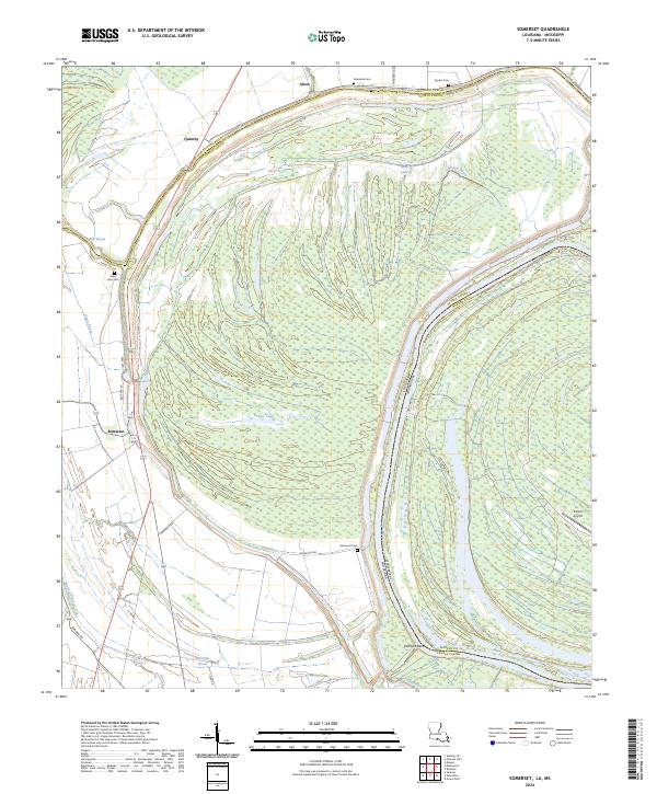
2024 Map of Somerset
USGS Topo · Published 2024About this map
The alluvial plains along the Louisiana Mississippi border define this landscape, where the meandering path of the river creates distinctive features like Palmyra Bend. Small settlements such as Somerset and Quimby are established along the transport corridors, with the northern edge of the Tensas River National Wildlife Refuge protecting the dense bottomland habitat to the northwest. This environment is shaped by a network of waterways, including Mill Bayou, Negro Bayou, and Grassy Lake, which reflect the historic drainage patterns of the Delta.
Find a feature on this map
34 named features on this map. Tap any name to fly to it.
Don’t see what you’re looking for? This feature index may not catch every label — zoom into the map to look around manually.
Map Details
Editions of this 2024 Somerset Map
This is the sole edition of this map. No revisions or reprints were ever made.
Other maps of this area

1909 · Mound
USGS Topo · 1:24,000

1910 · Mound
USGS Topo · 1:31,680

1935 · Waverly
USGS Topo · 1:62,500

1935 · Shackleford Lake
USGS Topo · 1:62,500

1939 · Talla Bena
USGS Topo · 1:62,500

1955 · Jackson
USGS Topo · 1:250,000

1958 · Shackleford Lake
USGS Topo · 1:62,500

1961 · Jackson
USGS Topo · 1:250,000

1961 · Waverly
USGS Topo · 1:62,500

1962 · Jackson
USGS Topo · 1:250,000