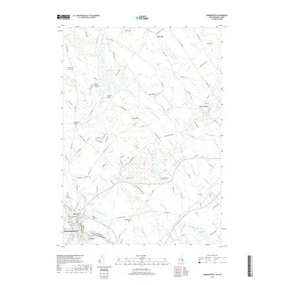
2018 Map of Somersworth
USGS Topo · Published 2018About this map
The Salmon Falls River serves as the dividing line between New Hampshire and Maine, where the industrial and residential centers of Somersworth and Berwick are situated. This modern survey illustrates the dense network of roads and waterways that define the border region, including the smaller settlement of Foundry and the Five Corners intersection. The landscape is characterized by a high concentration of wetlands and water bodies, such as The Marshes, Cranberry Meadow, and the Great Works River Reservoir.
Find a feature on this map
133 named features on this map. Tap any name to fly to it.
Don’t see what you’re looking for? This feature index may not catch every label — zoom into the map to look around manually.
Map Details
Editions of this 2018 Somersworth Map
This is the sole edition of this map. No revisions or reprints were ever made.
Other maps of this area

1891 · Berwick
USGS Topo · 1:62,500

1891 · Kennebunk
USGS Topo · 1:62,500

1893 · Kennebunk
USGS Topo · 1:62,500

1893 · Dover
USGS Topo · 1:62,500

1893 · Berwick
USGS Topo · 1:62,500

1893 · York
USGS Topo · 1:62,500

1898 · Kennebunk
USGS Topo · 1:62,500

1916 · Dover
USGS Topo · 1:62,500

1918 · Dover
USGS Topo · 1:62,500

1920 · York
USGS Topo · 1:62,500