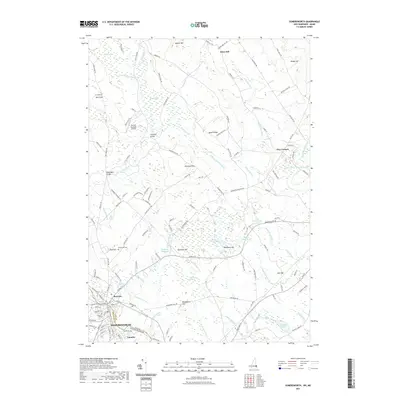
2021 Map of Somersworth
USGS Topo · Published 2021About this map
The Salmon Falls River serves as the geographic and economic spine of this borderland, separating Somersworth, New Hampshire, from Berwick, Maine. This modern survey illustrates the enduring settlement patterns of the river valley, where the historic Foundry district and the mills once powered by the water remain central to the urban landscape. Beyond the town centers, the terrain rises into a series of named heights such as Blackberry Hill and Diamond Hill, while the lowlands are defined by complex wetland systems like The Marshes and Cranberry Meadow. Genealogists and local historians can trace legacy transport routes and landmarks, including the Perrotti Skyranch Airfield and the Evergreen Cem. The hydrography is particularly detailed, showing the network of brooks—such as Togue Brook and Maple Swamp Brook—that feed into the Great Works River Reservoir.
Find a feature on this map
205 named features on this map. Tap any name to fly to it.
Don’t see what you’re looking for? This feature index may not catch every label — zoom into the map to look around manually.
Map Details
Editions of this 2021 Somersworth Map
This is the sole edition of this map. No revisions or reprints were ever made.
Other maps of this area

1891 · Berwick
USGS Topo · 1:62,500

1891 · Kennebunk
USGS Topo · 1:62,500

1893 · Kennebunk
USGS Topo · 1:62,500

1893 · Dover
USGS Topo · 1:62,500

1893 · Berwick
USGS Topo · 1:62,500

1893 · York
USGS Topo · 1:62,500

1898 · Kennebunk
USGS Topo · 1:62,500

1916 · Dover
USGS Topo · 1:62,500

1918 · Dover
USGS Topo · 1:62,500

1920 · York
USGS Topo · 1:62,500