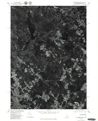
1977 Map of Somersworth
USGS Topo · Published 1979About this map
Somersworth and Berwick anchor the southern edge of this orthophotograph, captured in the spring of 1977. This aerial perspective, produced in cooperation with the Soil Conservation Service, reveals a landscape defined by fragmented woodlands and geometric agricultural clearings rather than traditional topographic contour lines. The Salmon Falls River acts as a clear border between New Hampshire and Maine, winding through the industrial and residential heart of these sister towns. Further north, the terrain transitions into a mosaic of rural land use, where the structural geography is punctuated by features like the Beaver Dam. This specific type of survey allows researchers to see the actual land cover and development patterns of the late seventies, offering a realistic look at the expansion of local neighborhoods and the state of the surrounding forests.
Find a feature on this map
3 named features on this map. Tap any name to fly to it.
Don’t see what you’re looking for? This feature index may not catch every label — zoom into the map to look around manually.
Map Details
Editions of this 1977 Somersworth Map
This is the sole edition of this map. No revisions or reprints were ever made.
Other maps of this area

1891 · Berwick
USGS Topo · 1:62,500

1891 · Kennebunk
USGS Topo · 1:62,500

1893 · Kennebunk
USGS Topo · 1:62,500

1893 · Dover
USGS Topo · 1:62,500

1893 · Berwick
USGS Topo · 1:62,500

1893 · York
USGS Topo · 1:62,500

1898 · Kennebunk
USGS Topo · 1:62,500

1916 · Dover
USGS Topo · 1:62,500

1918 · Dover
USGS Topo · 1:62,500

1920 · York
USGS Topo · 1:62,500