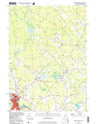
1998 Map of Somersworth
USGS Topo · Published 1999About this map
Somersworth and Berwick straddle the border between Maine and New Hampshire in this detailed topographic study. The landscape is defined by the winding course of the Little River and a network of wetlands including Beaver Dam Heath and Cranberry Meadow. The urban core of Somersworth shows a concentration of civic life with the Town Hall and Foundry near the river, while the surrounding countryside is dotted with family-named landmarks and rural institutions.
Find a feature on this map
72 named features on this map. Tap any name to fly to it.
Don’t see what you’re looking for? This feature index may not catch every label — zoom into the map to look around manually.
Map Details
Editions of this 1998 Somersworth Map
This is the sole edition of this map. No revisions or reprints were ever made.
Other maps of this area

1891 · Berwick
USGS Topo · 1:62,500

1891 · Kennebunk
USGS Topo · 1:62,500

1893 · Kennebunk
USGS Topo · 1:62,500

1893 · Dover
USGS Topo · 1:62,500

1893 · Berwick
USGS Topo · 1:62,500

1893 · York
USGS Topo · 1:62,500

1898 · Kennebunk
USGS Topo · 1:62,500

1916 · Dover
USGS Topo · 1:62,500

1918 · Dover
USGS Topo · 1:62,500

1920 · York
USGS Topo · 1:62,500