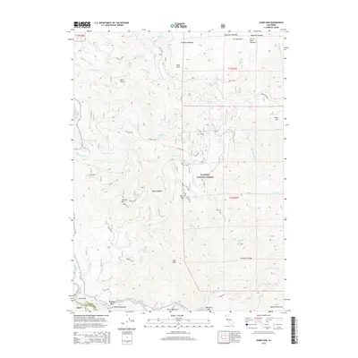
2015 Map of Somes Bar
USGS Topo · Published 2015About this map
The Salmon River meets the Klamath River in this section of the Klamath National Forest, marking a landscape defined by significant elevation changes and remote river bars. Settlement is concentrated at Somes Bar near the river confluence, while further downstream and along the banks lie the curiously named Three Dollar Bar and Murderers Bar. The terrain rises sharply from the river canyons toward peaks such as Offield Mtn and East Peak, connected by high-altitude features like Offield Saddle.
Find a feature on this map
50 named features on this map. Tap any name to fly to it.
Don’t see what you’re looking for? This feature index may not catch every label — zoom into the map to look around manually.
Map Details
Editions of this 2015 Somes Bar Map
This is the sole edition of this map. No revisions or reprints were ever made.
Other maps of this area

1914 · Seiad
USGS Topo · 1:125,000

1922 · Preston Peak
USGS Topo · 1:125,000

1922 · Seiad
USGS Topo · 1:125,000

1925 · Hoopa
USGS Topo · 1:125,000

1948 · Weed
USGS Topo · 1:250,000

1950 · Weed
USGS Topo · 1:250,000

1952 · Orleans
USGS Topo · 1:62,500

1955 · Dillon Mtn
USGS Topo · 1:62,500

1955 · Ukonom Lake
USGS Topo · 1:62,500

1955 · Forks of Salmon
USGS Topo · 1:62,500